
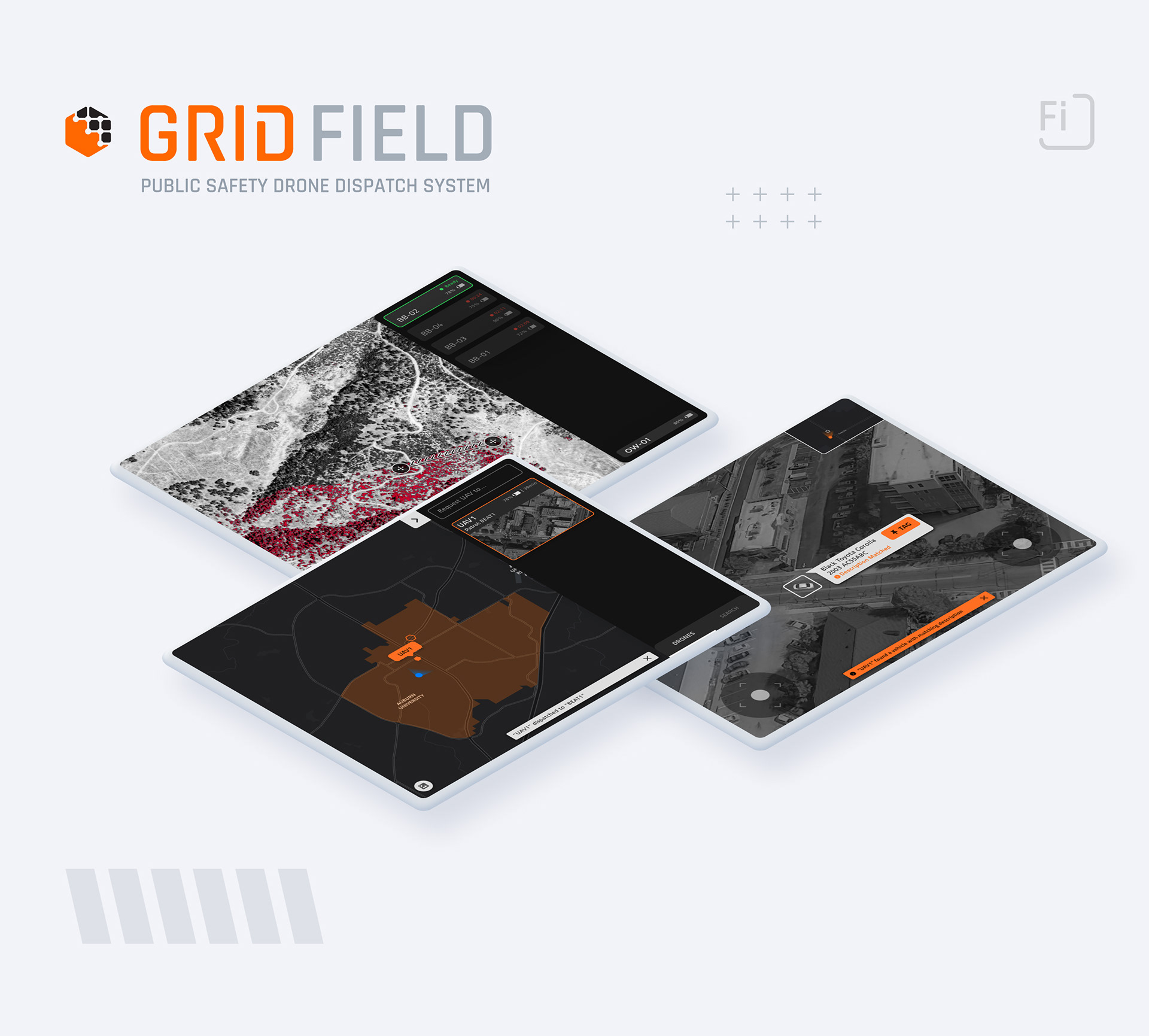
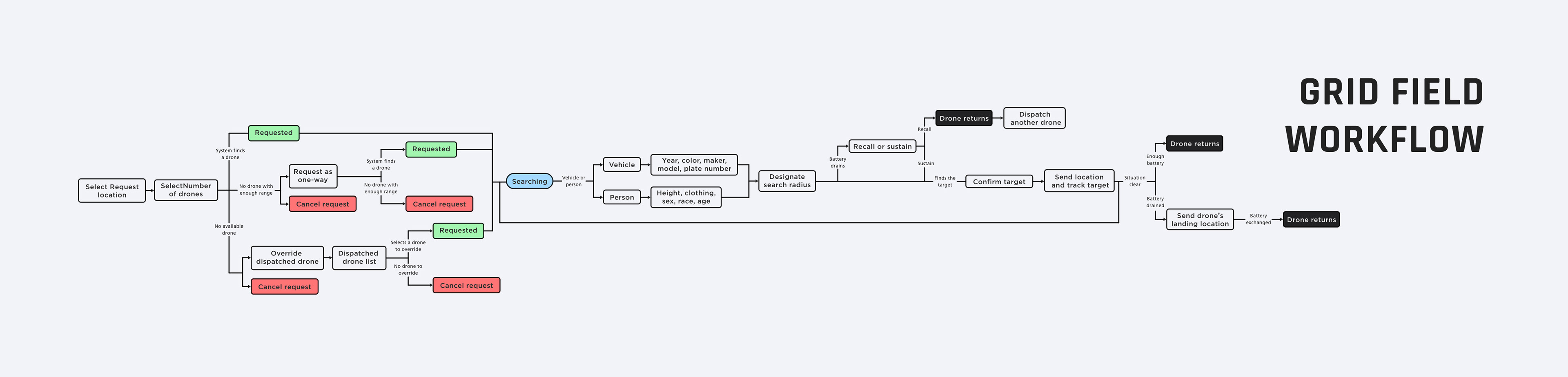
Grid Field is a tablet variant designed for ground units (police and firefighters) and shares the majority of features with Grid Dispatch. Grid Field allows ground units to request drones and view a drone's camera footages to utilize it for patrol or scenarios such as search & rescue.
This part of the project was cut short due to Covid-19, and I was unable to test the prototype and make iterations. But you can view screens below.
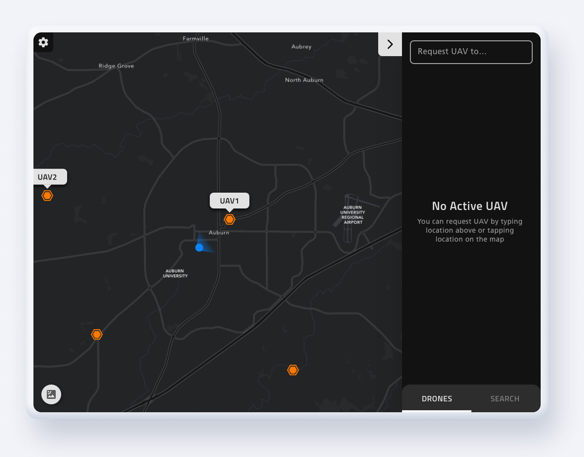
Dashboard (Default)
The dashboard displays a map which indicates drone and user's location and the direction it is facing.
Request Drones
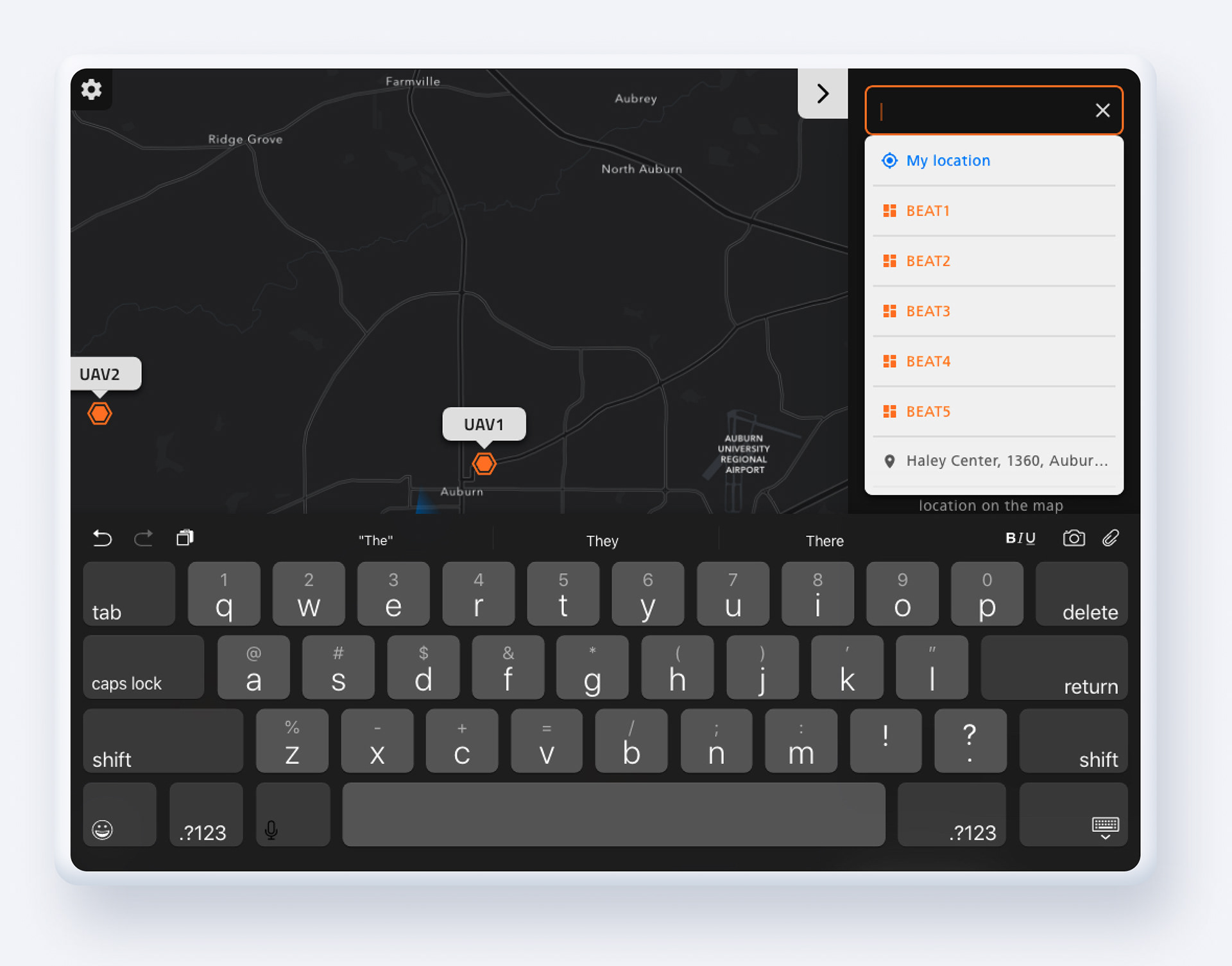
Users can request drones to their location, predesignated beat, or address by tapping the input field on the top left corner.
Unlike Grid Dispatch, Grid Field only allows first responders to request a drone equipped with extra batteries. This is because first responders will request drones to utilize drone's cameras and police and fire units carry AED and Narcan in their vehicle.
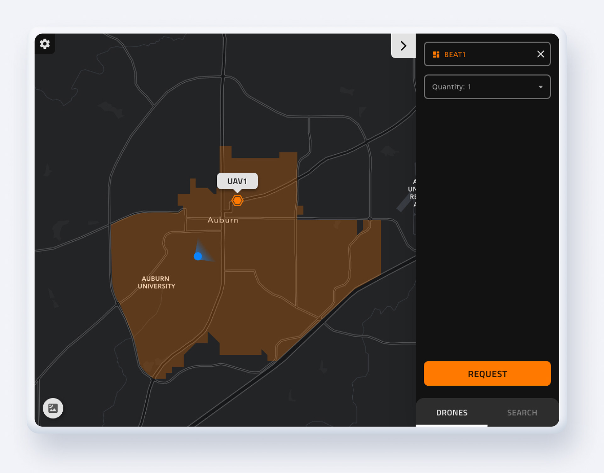
Request Drones (Beat)
If users select one of the predesignated beats as a request location, the system will highlight and zooms into a predesignated area on the map. Then users can specify the number of drones they are requesting by using the dropdown. Once drones are requested, they will hover over the highlighted area to provide aerial footage.
Allowing police officers to dispatch drones to predesignate beats is useful for routine patrol and making sure two different drones to not search the same area.
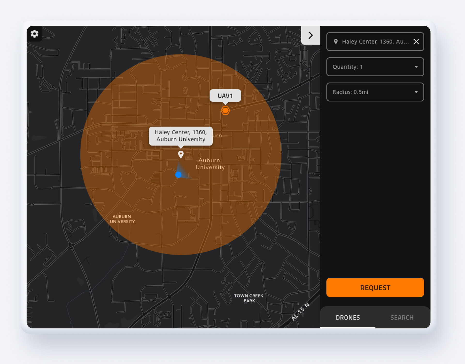
Request Drones (My Location/Address)
If users select "My Location" or types in a specific address, the map will center and zooms into the specified location. Then users can specify the number of drones and search radius by using the dropdown.
Once drones are requested, they will hover over the highlighted area to provide aerial footage.
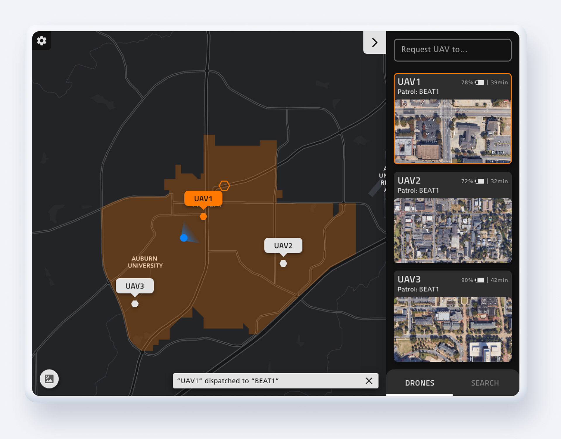
Dashboard (Active)
When drones are dispatched by a user or other users (including dispatchers), the system displays dispatched drone's camera footage as a thumbnail on the right panel. If user taps one of the thumbnails, system full screens that drone's live footage.
A user can tap a drone's name tag on the map, which centers the drone and highlights it in orange.
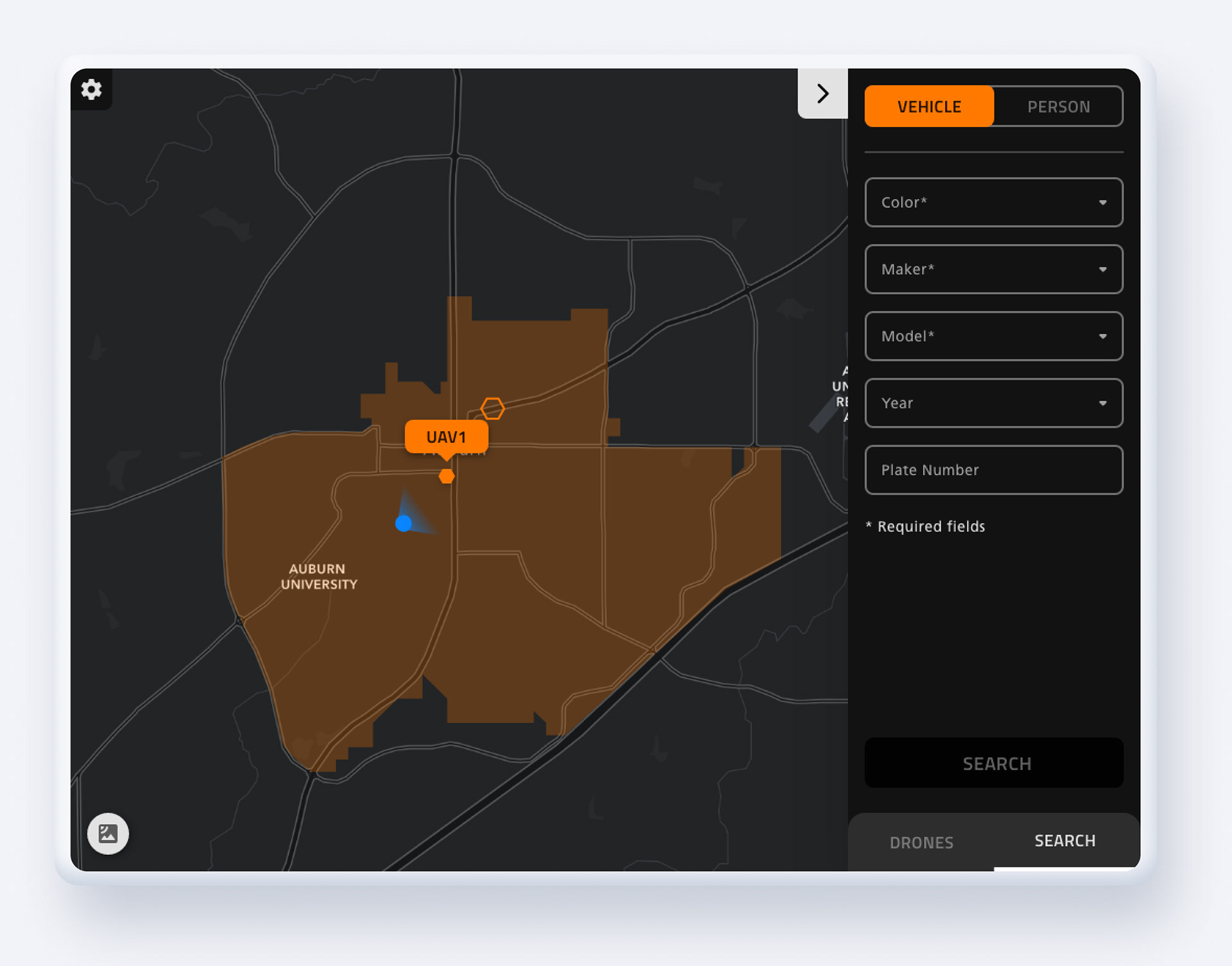
Search Tab
Users can access the search tab by tapping the word "SEARCH" on the bottom right corner. Users can put in the description of a vehicle or a person by using drop-downs (it's exactly same as Grid Dispatch). Once descriptions are inputted, requested drones will hover over the highlighted areas on the map and search for a matching subject.
Once a drone locates a matching subject, the system will give notification to a user and display that drone's live footage in full screen.
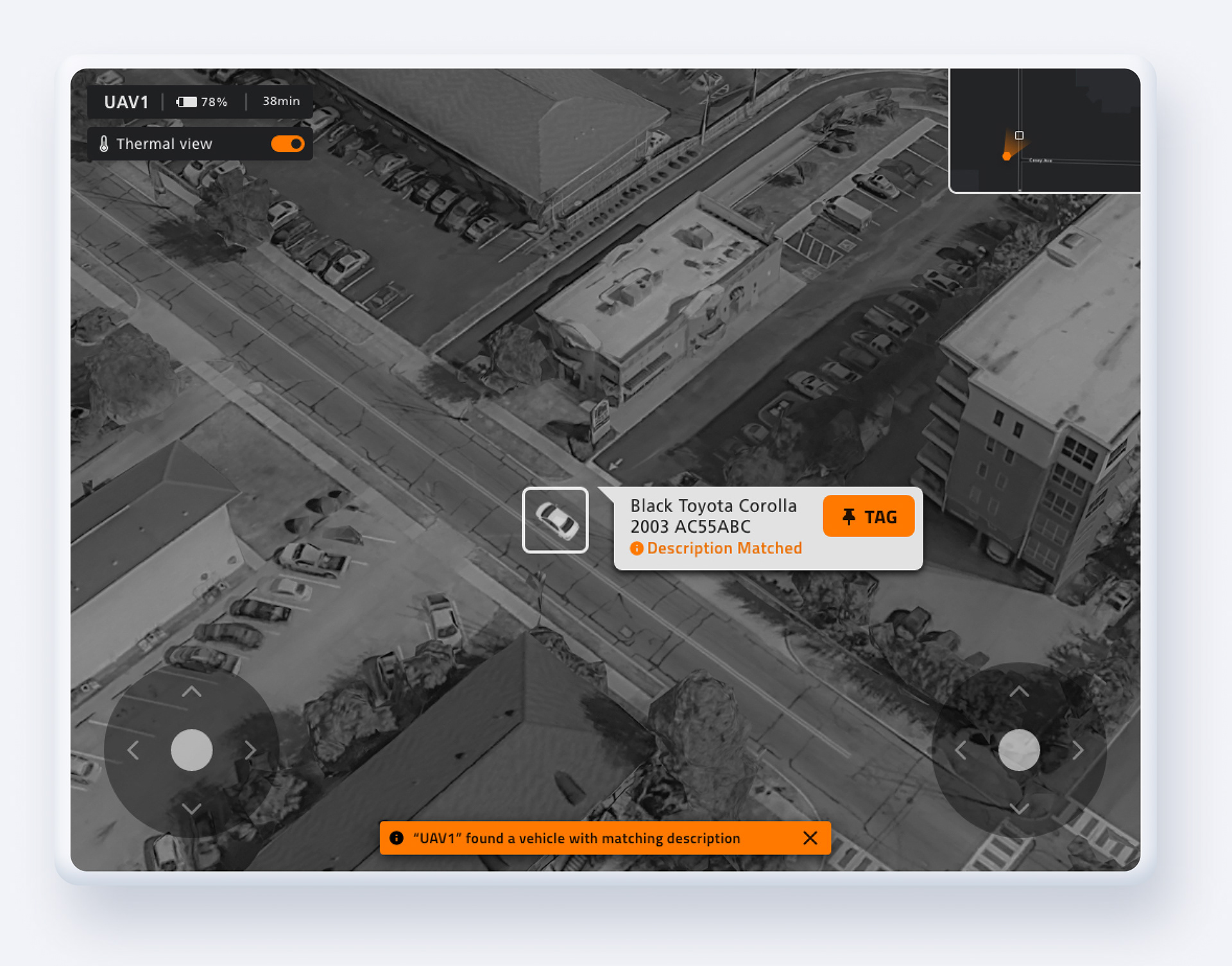
Live Drone Footage
Users can view drone's live footage in full screen by tapping one of the thumbnails from the dashboard screen. On the live footage screen, users can view the drone's current location using a mini-map on the top right corner. Users can go back to the dashboard by tapping this mini-map.
Also, users can manually control the drone if needed by using a joystick interface on the bottom right and left corner of the screen.
Finally, once the drone detects vehicles or people based on a heat signature, users can tag it. If users tag a vehicle or a person, the drone will automatically follow the tagged subject.
Walkthrough Video